


|
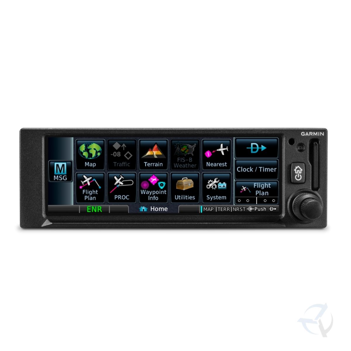
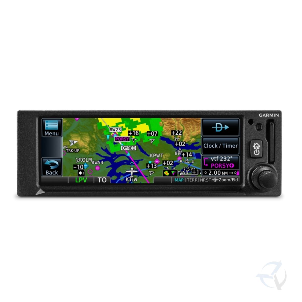
Big capabilities come in a small package with the GPS 175 navigator. With its bright, clear high-resolution touchscreen display, you can have the advanced navigation functions you’ve always dreamed of. Entering flight information is a cinch, and accessing every function is fast and easy. It’s equally at home in certificated aircraft or an experimental aircraft. And it’s the same 2” height as older navigation equipment and can allow you to keep the legacy composite CDI already in your aircraft to minimize installation cost¹. That makes GPS 175 the smart, affordable way to add next-generation navigation to your favourite airplane.
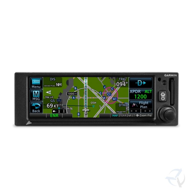
Perfect Touch
The moment you power up GPS 175, you’ll see a familiar Garmin homepage on the 4.8” display, which puts the most important functions within only a few touches. Navigate to dedicated pages for the moving map, terrain, nearest airports, flight plan, procedures, way point information, utilities and more. With shortcuts available to the flight plan and Direct-to functions on almost every page, navigation features are usually just a tap away. Use your finger to pan and zoom on any map, traffic and terrain page. Enter way point data with the on-screen keyboard. And touch the home button to get you back to the main page at any time. For added control stability in flight, a shelf across the lower edge of the display serves to steady your hand in smooth and turbulent flight conditions. And if you prefer traditional controls, the concentric knobs provide yet another way to control many of the GPS 175 navigator’s functions.
|
 |
|
Intuitive Navigation
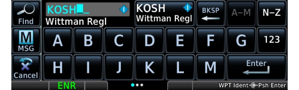
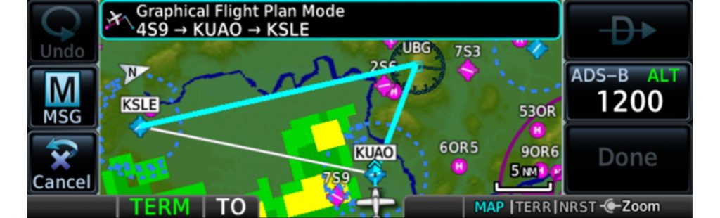
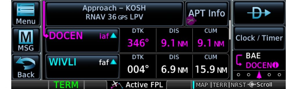
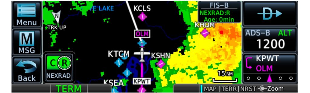
With GPS 175, building and modifying flight plans is simple. As you enter way points, our FastFind feature automatically begins searching for the nearest identifier as soon as you start typing, so — in most situations — a press or 2 reveals just what you were thinking. You can also create holds, insert Victor airways and corresponding exit options, and add departures, arrivals and instrument/visual approach procedures. Additionally, you can edit your route using the map screen; a handy “rubber band” feature lets you grab any leg of your flight plan route and move it to accommodate a deviation or ATC amendment to your flight plan. A variety of dynamically drawn and displayed maps provide situational awareness and context to the flight plan by highlighting visual reporting points, navaids, SafeTaxi® diagrams and hazards such as obstacles, power lines and terrain. Plus, the Smart Airspace™ feature automatically highlights airspace close to your current altitude and de-emphasizes airspace away from the current altitude.
|
 |
|
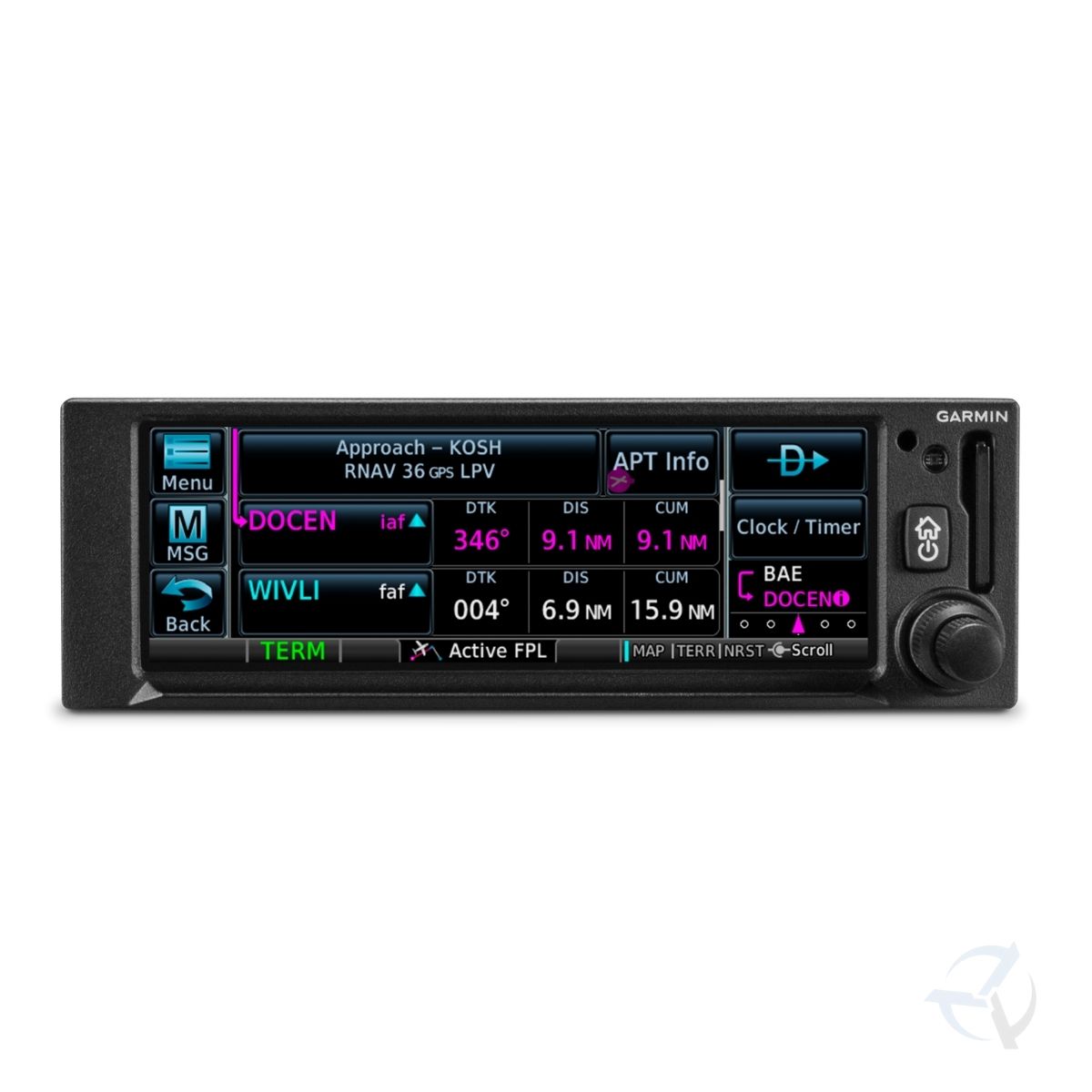
Advanced Approach to IFR
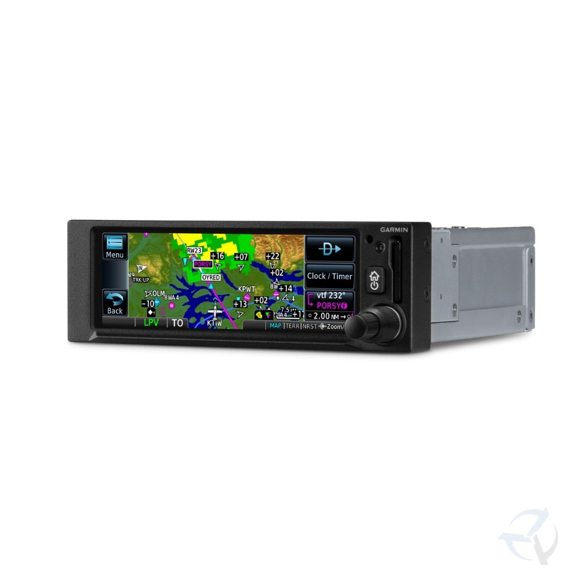
The SBAS/WAAS-certified GPS receiver can allow you to fly GPS-guided LPV*glidepath instrument approaches down to as low as 200’, greatly expanding your operational capability. (*This approach capability requires an operational SBAS infrastructure, not currently active in Australia or a BARO-Aided Altitude input) You can also access newer localizer performance (LP) and all area navigation (RNAV) approaches. Precise course deviation and roll steering outputs can be coupled to our GFC™ 500 and GFC 600 autopilots as well as select third-party autopilots so that IFR flight procedures such as holds, NextGen radius-to-fix (RF) legs and missed approaches may be flown automatically. In addition, the GPS 175 navigator lets you create and execute custom holding patterns over an existing waypoint or user-defined waypoint. Plus, when operating in VFR conditions, GPS 175 can provide advisory vertical approach guidance based on a published glide path angle or a 3-degree approach glide slope from the runway threshold, while considering terrain and obstacle clearance. With this advisory guidance, you’re able to fly more consistent, precise vertical glide paths into a variety of airfields.
|
 |
|
Add ADS-B Traffic and Weather
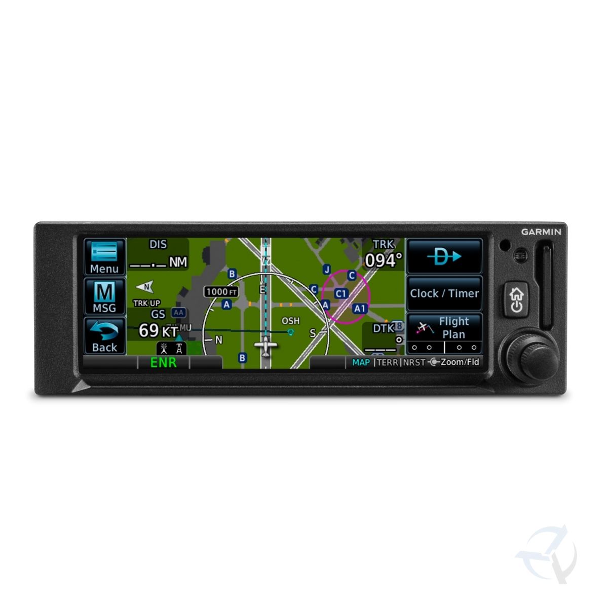
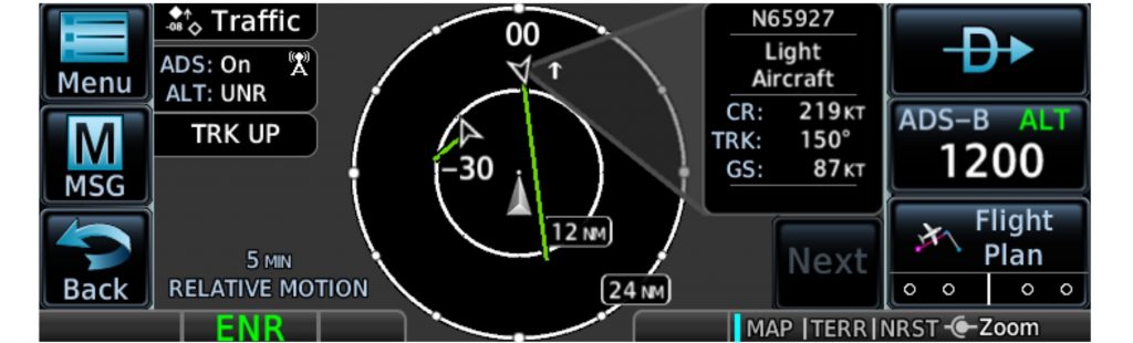
When paired with dual-link Garmin ADS-B solutions, such as a GTX™ 345 series transponder , GPS 175 can display ADS-B traffic targets. Or you can opt for the GNX™ 375 navigator, which offers the same capabilities as GPS 175, but includes a transponder for ADS-B “Out” and “In.” When equipped with a compatible ADS-B solution, visual alerts help you recognize and avoid potential conflicts in busy airspace. Our patented TargetTrend™ relative motion technology offers a faster, more intuitive way to judge the direction and closure rate of intruding targets in relation to your aircraft’s position. For example, if traffic is ahead of you and traveling along the same track but at a slower rate, the motion vector would point opposite of its indicated direction of flight to show you are overtaking the traffic. And, at the start or end of each flight, TerminalTraffic™ technology provides the most comprehensive picture of ADS-B equipped aircraft and ground vehicles in the airport environment. ADS-B equipped aircraft in-flight are easily distinguished from ground vehicles and taxiing aircraft, which are displayed using distinct colors and symbols. All information is presented on a simple, easy-to-understand SafeTaxi diagram with reference to runways, taxiways, hangar locations and more.
|
 |
 |
|
Cockpit Integration
The GPS 175 navigator interfaces with a variety of Garmin flight displays, including G3X Touch (experimental and certified), G5 (experimental and certified), G500/G600, G500 TXi/G600 TXi as well as select third-party displays1. Plus, it’s also compatible with many legacy, composite-input based CDIs — allowing you to keep your existing CDI and have an easier, more cost-effective installation¹.And for even more work-saving convenience, you can use the built-in Connext® technology to stream information between GPS 175 and compatible Garmin portables and mobile devices running the Garmin Pilot™ or FltPlan Go apps. You can create flight plans at home and upload them at the airport. And you can stream GPS data and backup attitude information (from the built-in AHRS) to your mobile device or Garmin portable, making them even more useful cockpit companions. Better still, you can also share ADS-B traffic and weather information if you’re equipped with a compatible ADS-B solution. Plus, our optional Flight Stream 510 installs in the memory card slot of GPS 175 to enable our Database Concierge database transfer and management capabilities via our Connext® gateway. At home, you can download selected databases onto your mobile device by using the Garmin Pilot™ app. Then, once you get to the airport, Flight Stream 510 will automatically establish a wireless connection to the Garmin Pilot™ app and upload the databases from your device to your GPS 175 in minutes.
|
 |
|
Learn More About GPS 175
With installation approval available for hundreds of Part 23 Class I/II aircraft models, adding a GPS 175 navigator to your cockpit is a straightforward, all-bases-covered proposition. To better familiarize yourself with the system, a free training app is available for iPad® mobile devices on the App Store®. And for worry-free flying, it comes with an industry-leading 2-year warranty, backed by our award-winning product support team. See Pacific Avionics your local authorized Garmin installation center for more information on scheduling a GPS 175 upgrade for your aircraft. And experience the navigation capabilities your aircraft has been missing.
1See interfaces tab to verify compatibility Pad and App Store are trademarks of Apple Inc., registered in the U.S. and other countries. |
Reviews
There are no reviews yet.