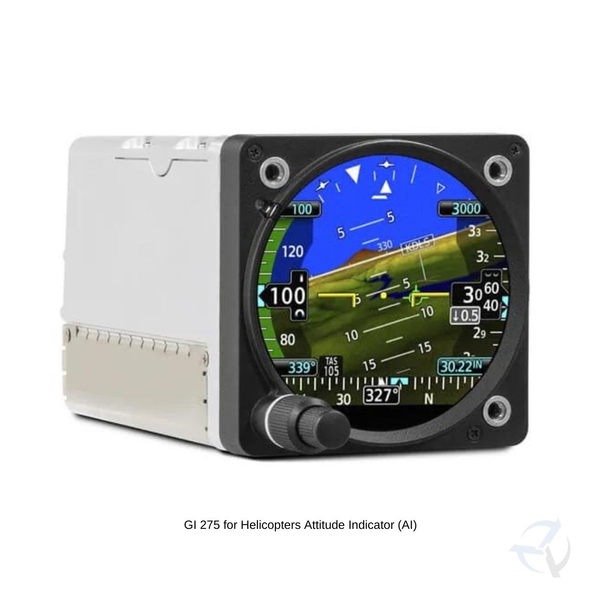
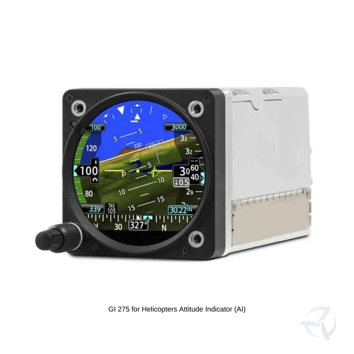


Out with the old, in with the new. It flush mounts in a standard 3-1/8” round cutout.
|

STC approval is coming soon for select Part 27 helicopters
|

How do you see it? Attitude, altitude, airspeed, CDI, HSI, MFD or EIS.
|

It comes with built-in VFR GPS — and it’s available with precise digital ADAHRS.
|

Connect your cockpit with built-in Wi-Fi® connectivity and BLUETOOTH® technology.
|
Know you’ll get home with up to 60 minutes of optional backup battery power.
|


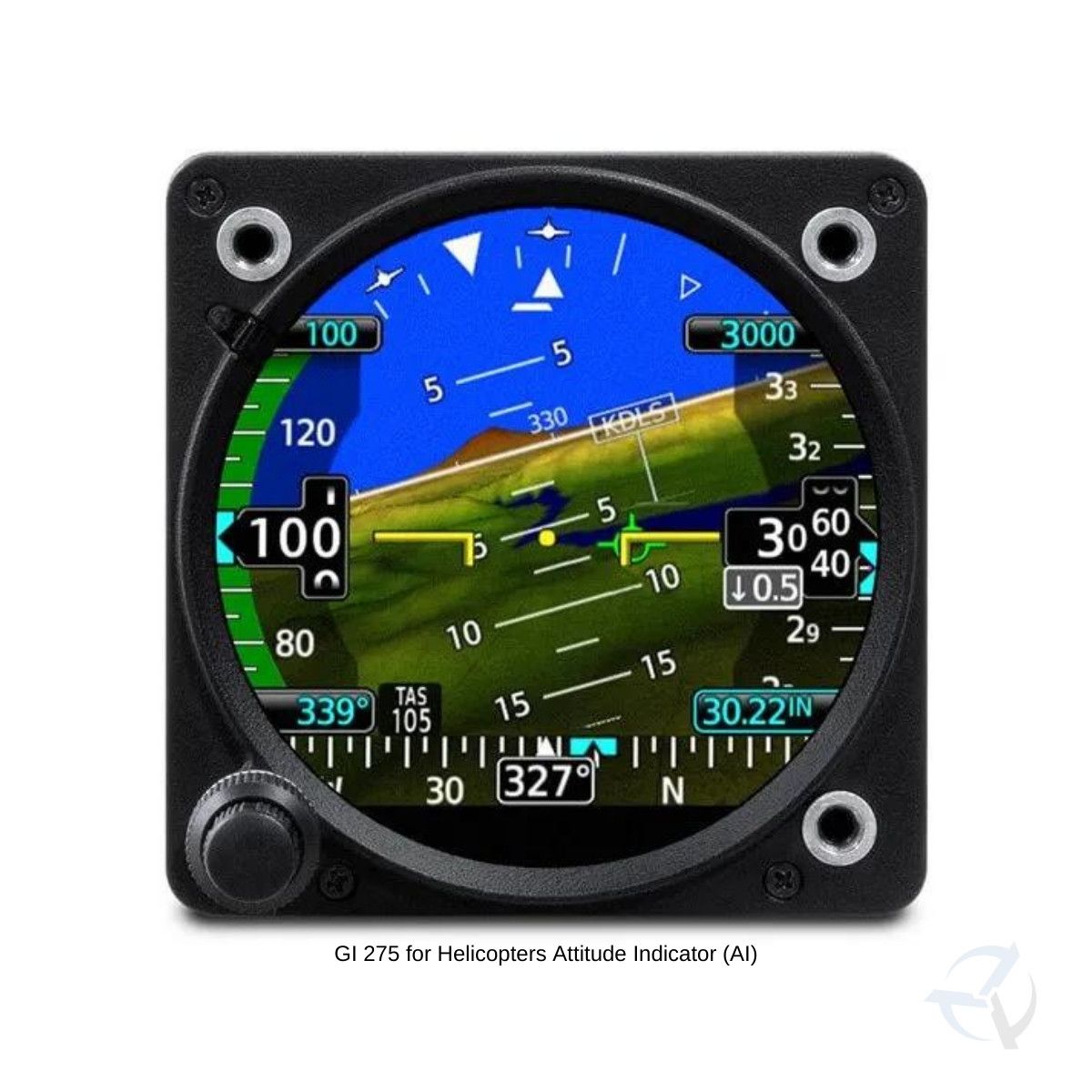
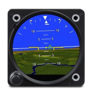
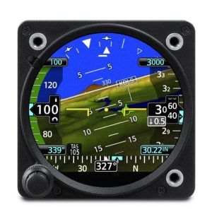
BASIC ATTITUDESave weight and maintenance expense: replace that aging vacuum pump-driven attitude indicator with a reliable solid-state ADAHRS-driven GI 275 electronic display.
|

A LESS ARTIFICIAL HORIZONTo add situational awareness, your display can overlay attitude reference on an optional Garmin HSVT™ synthetic vision landscape with WireAware™ wire-strike avoidance technology.
|
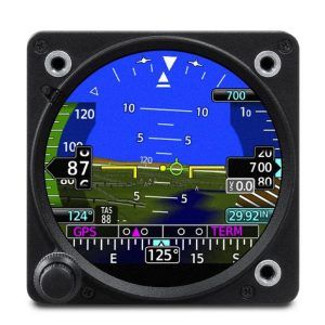
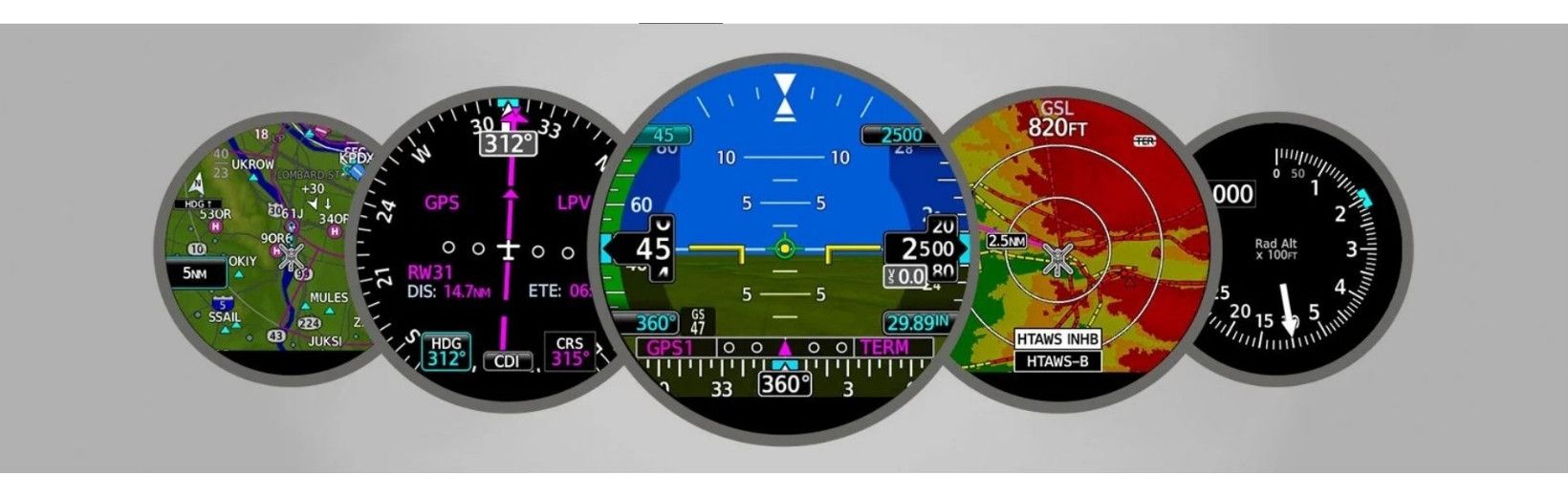
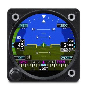
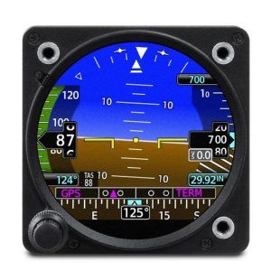
INSTRUMENT CONSOLIDATIONAs your primary flight reference instrument, GI 275 features an integrated display to support all the essential readouts — attitude, altitude, airspeed and heading.
|
EDGE-TO-EDGE DISPLAYThe bright, high-resolution GI 275 touchscreen is sunlight-readable and maximizes the available space within the instrument panel cutout.
|
REFERENCE MARKERSThe GI 275 instrument can support display of selectable alerts to mark your arrival at a preselected altitude, heading or airspeed.
|
STANDBY ADIGI 275 can function as a standalone standby flight instrument to back up existing attitude indicators or flight displays.
|

KNOB OR TOUCH CONTROLSThe touchscreen on GI 275 makes accessing its functions a breeze. A traditional concentric knob is also available for those who prefer that style of data input.
|
|
|

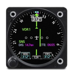
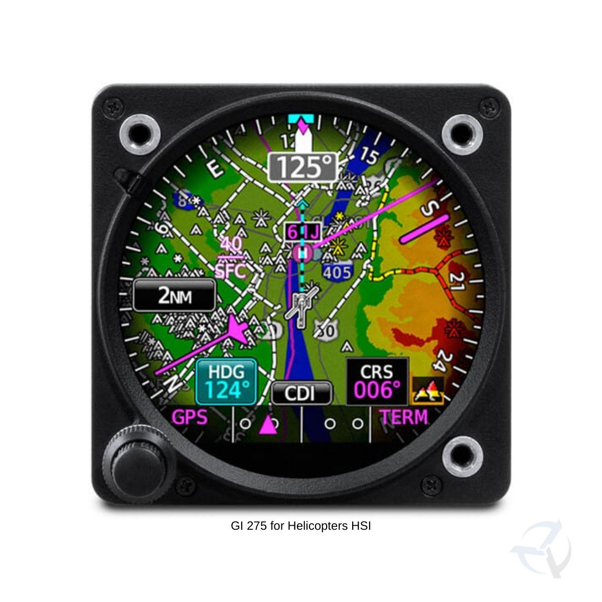
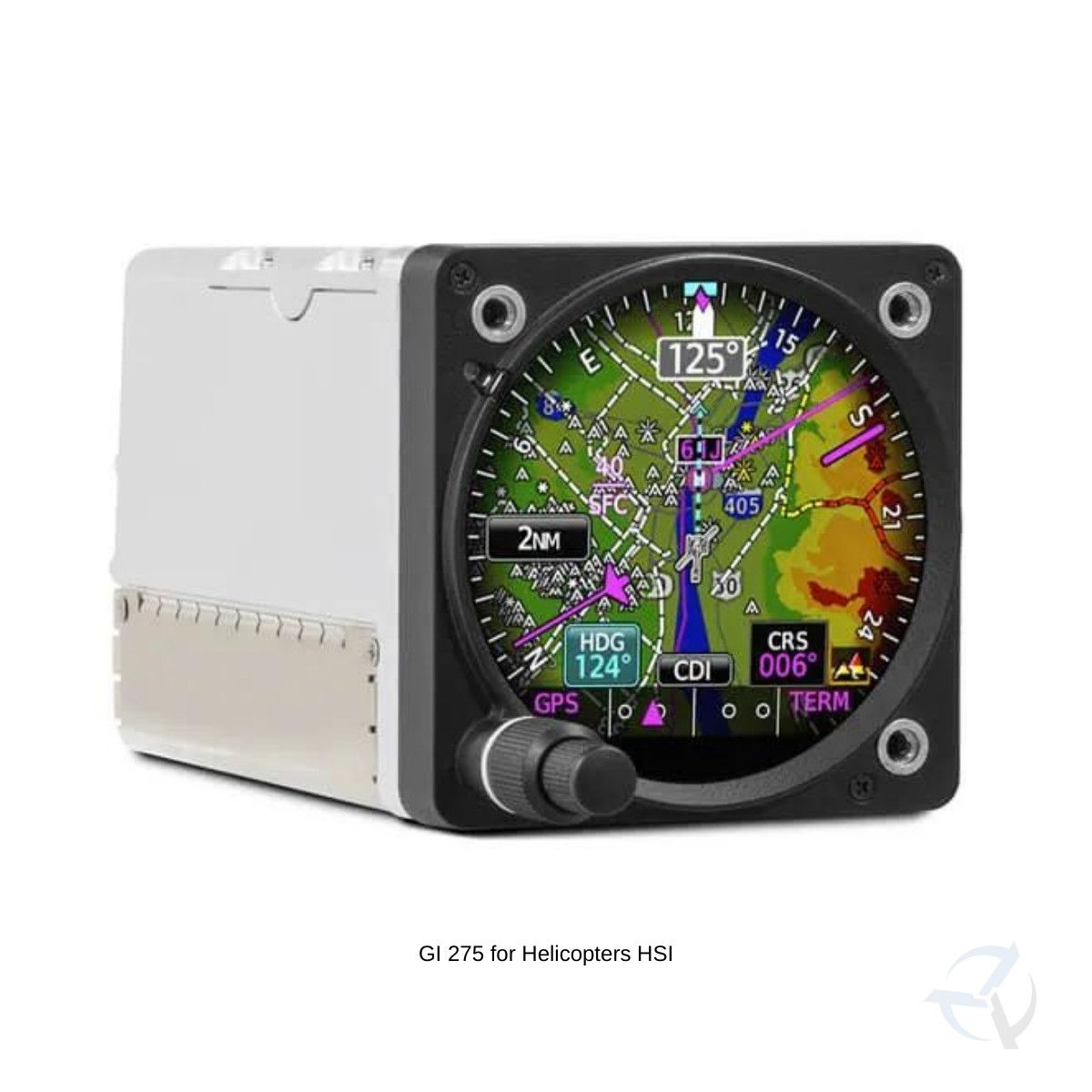
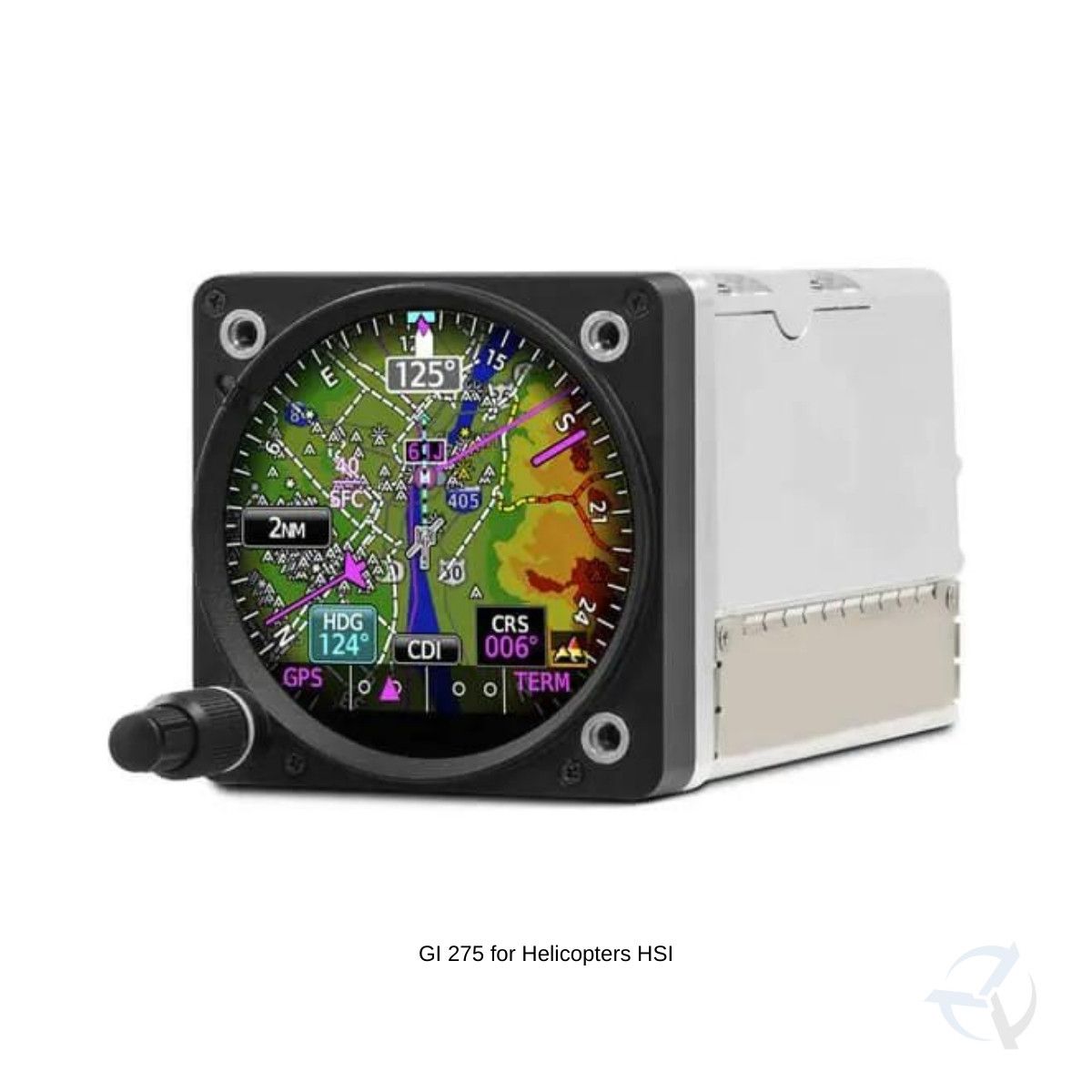
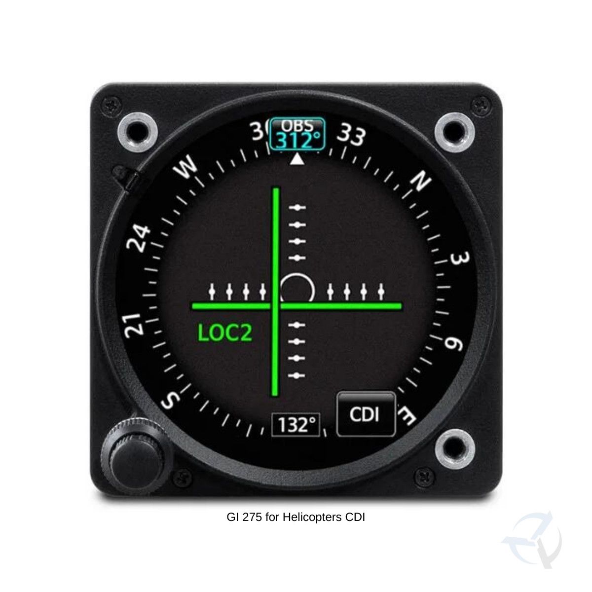
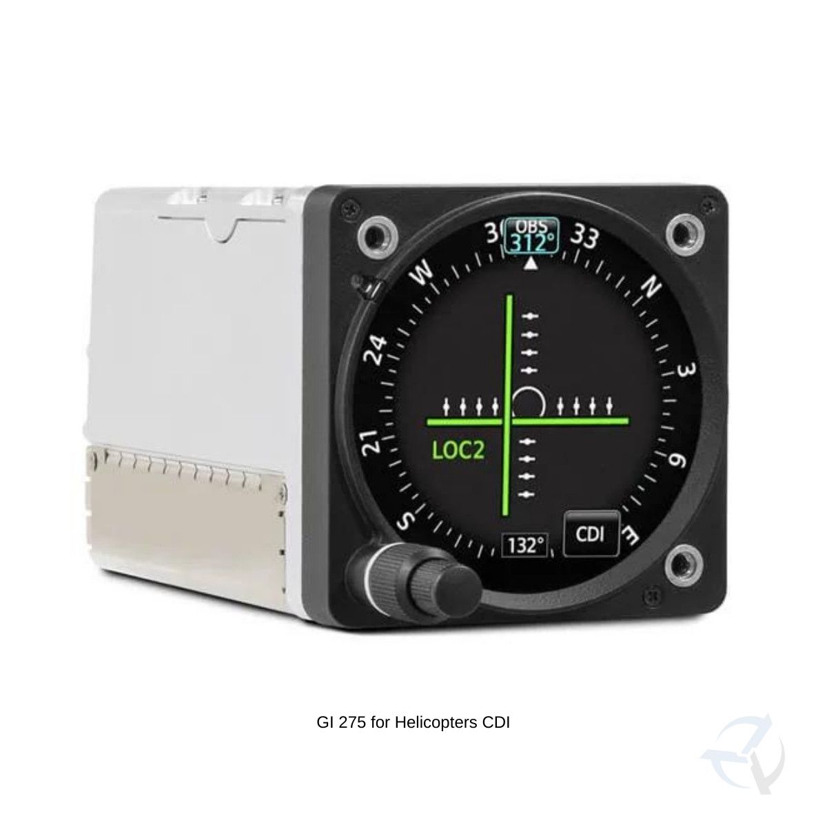
NAVIGATION GUIDANCEIn addition to primary magnetic heading reference, GI 275 can accept inputs for VOR/LOC and/or GPS course guidance — along with distance and groundspeed indications.
|
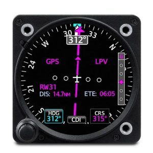
TRACK IN ALL DIMENSIONSFor climb/descent profiles and approaches, GI 275 can display both vertical and lateral GPS/VOR/LOC course deviation cues, when available.
|
ENHANCED HSIWith appropriate NAV inputs, GI 275 can optionally add HSI course guidance overlaid on a moving map display with flight plan legs, terrain, obstacles wires, weather and more.
|
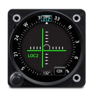
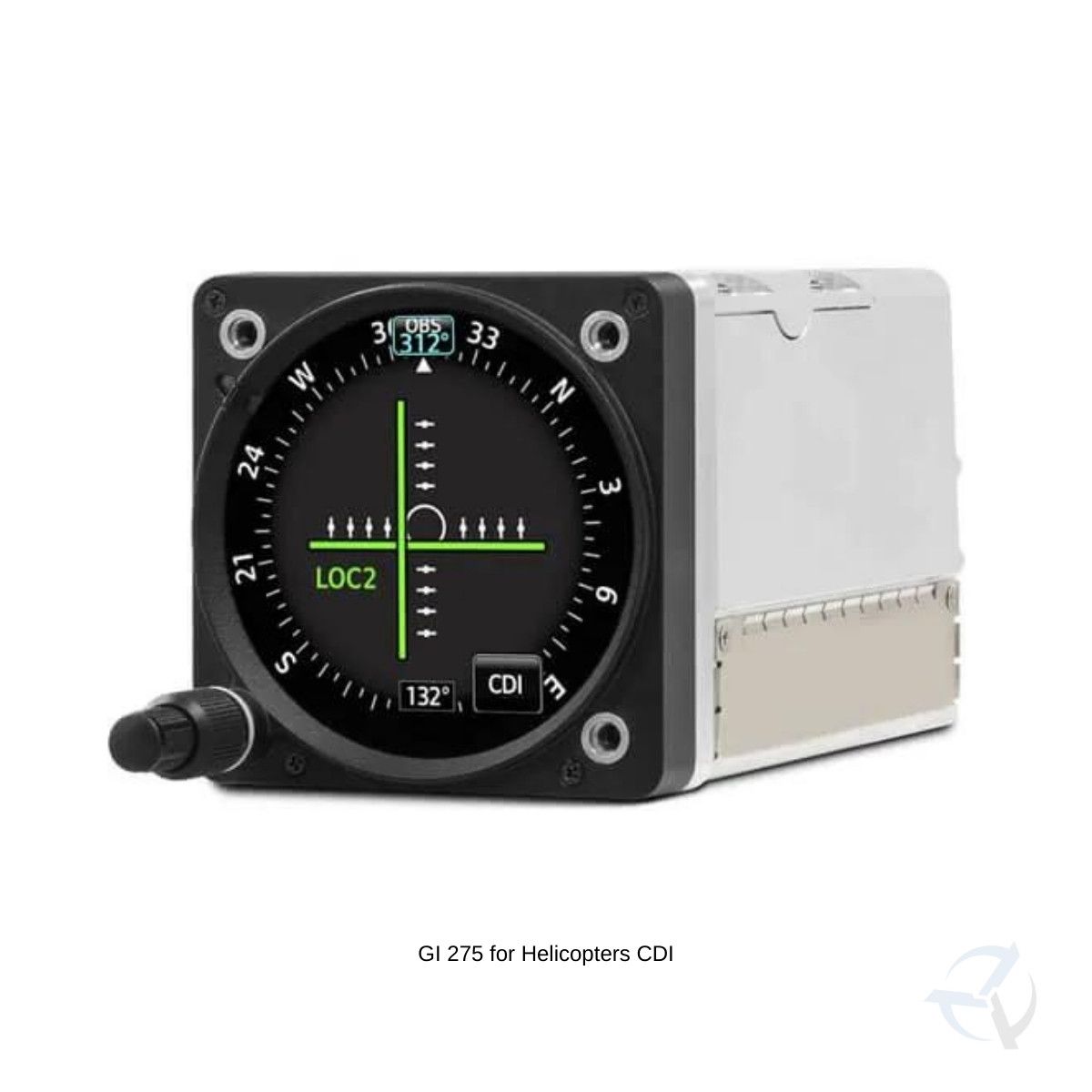
COMPLETE CDI SOLUTIONWhen paired with select VHF NAV/COMMS or GPS navigators, GI 275 can serve as your primary indicator for making, adjusting and tracking course selections.
|
DUAL ADVANTAGESWith dual GI 275 displays as your primary flight instrumentation, reversionary backup capability retains attitude and heading data on the remaining HSI or MFD if an outage should occur1.
|
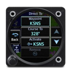
DIRECT-TOBuilt-in VFR GPS navigation enables convenient Direct-to guidance with position depicted on the moving map display.
|

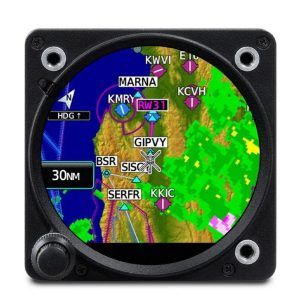
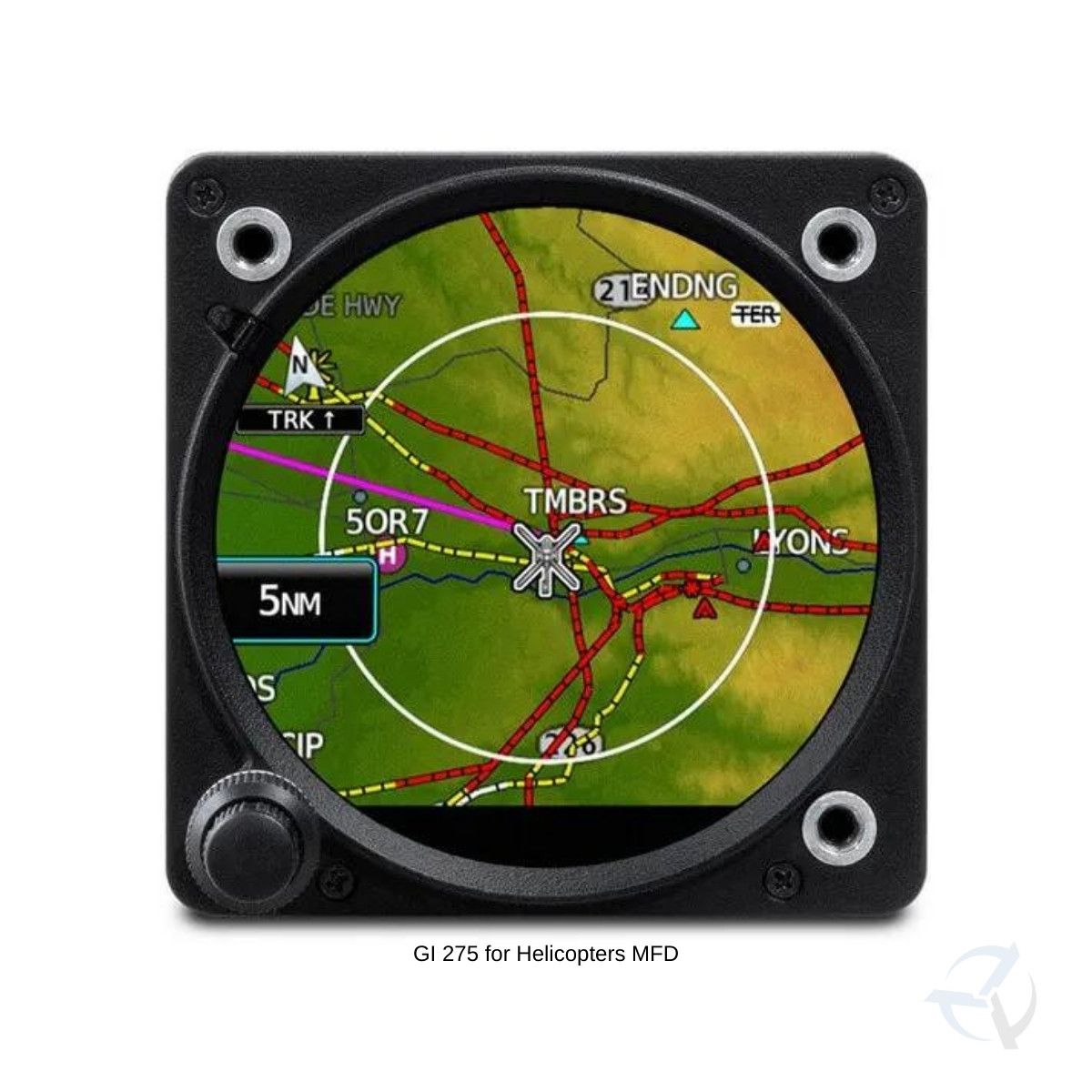
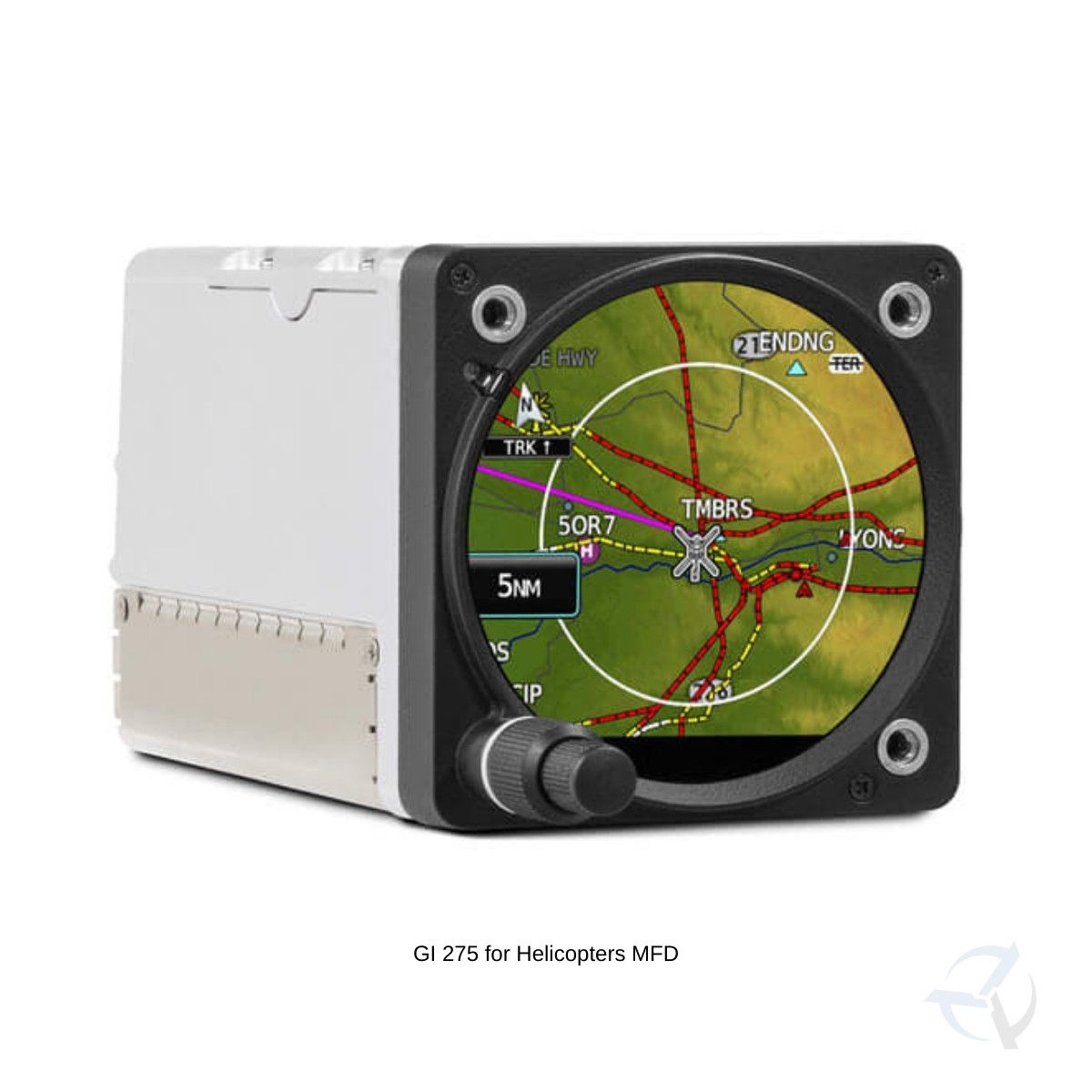
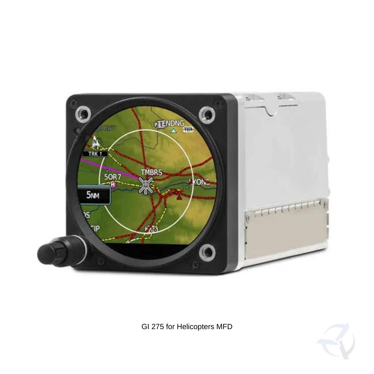
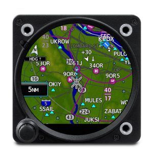
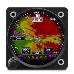
MULTIFUNCTION DISPLAYWhen configured as an MFD, GI 275 can serve multiple roles, supporting displays for moving map, traffic, terrain, wires and obstacles, weather, CDI and more.
|
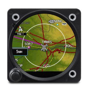
MOVING MAPWithin the MFD configuration, a dynamic moving map page offers views of terrain, obstacles, wires, airports, airspace boundaries, navaids, flight plan routings and more. |
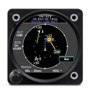
TRAFFIC AND WEATHERWith select ADS-B “In” datalinks, GI 275 MFD pages will support subscription-free U.S. weather and traffic displays, including TargetTrend™ and TerminalTraffic™ technologies.
|
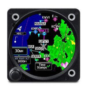
ANIMATED NEXRADWhen paired with an optional GDL® 69 SiriusXM® receiver, the MFD-configured GI 275 offers display capability for satellite weather coverage with graphical NEXRAD imagery.
|

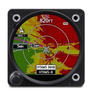
RADAR ALTIMETERFor applications that require precise tracking of aircraft altitude above the terrain, GI 275 can be configured as a dedicated display for select radar altimeters, including our GRA™ altimeter series (sold separately). |
|
OUTSIDE AIR TEMPERATUREPair GI 275 with an optional GTP 59 OAT probe to see true airspeed, density altitude and other essential flight calculations.
|
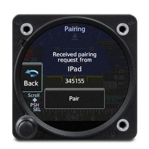
WIRELESS DATA STREAMINGUse built-in wireless connectivity to share data between GI 275 and compatible mobile apps. Import databases. Stream weather, traffic, attitude information and more3. |
|
Reviews
There are no reviews yet.